Deprecated
Google has now stopped its Earth API and Maps API is a paid for API nowadays. Some capabilities have also been either removed or changed. Therefore, I had to remove all examples of VizMap applications I had created. I didn’t remove the entire topic as I thought some of the code may still be useful with some modifications.
When you click on an infobox, use a quicklink or select a category on a generated map the zoom level will change (if you have enabled it in your excel parameters.).
Click on an infobox or use a quicklink
Here I selected a single marker, and it zoomed in to the level I specified in the ‘zoomlevelonselect’ parameter in my geocoding parameter sheet.
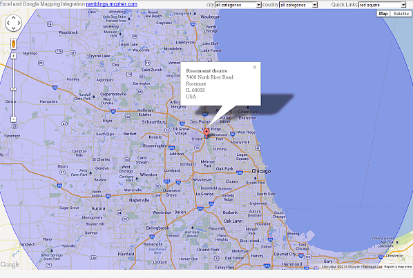
Clicking on the marker again will restore to its regular size.
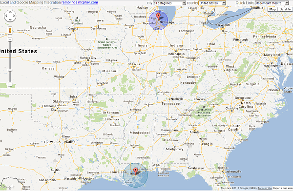
Select a category
In this case, it will resize according to bounding box rules, if enabled by the “resizeboundingbox” parameter. This means that it will zoom to the maximum it can but still show all selected items. For Example, here I select the category “united states”. and it resizes to show the two places in US. To reset, just select all categories.
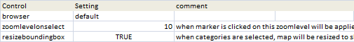
The Excel parameters
These are on the geocoding parameters sheet and look like this
See here for more about Integrating Excel with Maps and Earth.
For help and more information join our forum,follow the blog or follow me on Twitter .