Yesterday, I showed how to get all the f1 circuit names and locations using the Ergast API along with the Rest-Excel library.
Now we have that data to play with, why not visualize them on Google Earth or Maps using a vizMap application generated straight from the data.
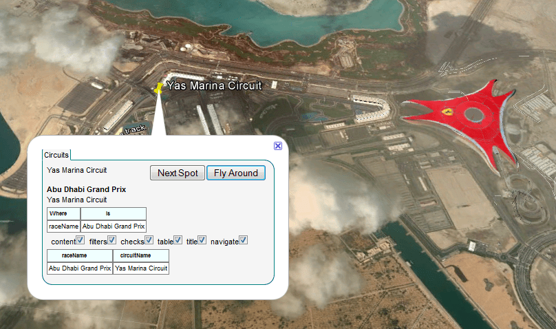
A little parameter tweaking gives us all the f1 circuits ever, plotted on Google Earth or Maps, and we can fly around them and have a look to see which ones are still actually tracks. Later I’ll add some charts and tables with race stats. Here’s a look at the Abu Dhabi track from the vizMap application.
Download the GoogleMapping.xlsm workbook from the ramblings site, and generate your own. Why not follow this blog or join our forum to watch out for when I put some stats on this.