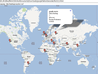
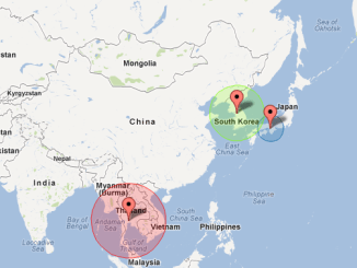
infoBox for google Map popups
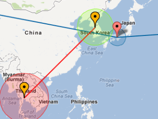
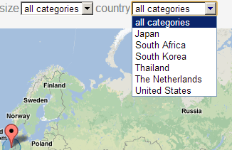
What is the infoBox An infoBox is an enhanced infoWindow. Details can be found here . I will be converting the Google Maps modules on this site to use the infoBox rather than the native Google Maps […]
javaScript:creating google visualization DataTables This relates to Data Driven Mapping applications and the Javascript HowTo section Google Visualization Tables I have covered Google Visualization in various forms with an ‘Excel slant’ on this site. Let’s take a look […]
If you have a business account for Google Mapping, you’ll need to provide your client id and crypto key. These things are meant to be kept private, so I did not provide a mechanism for […]
Plotting markers on on a Google Earth This article will cover how to create a basic KML file so that your Excel data can be mapped on Google Earth. There is a more advanced implementation […]
Overlaying polyLines to make flight paths on google markers This article will cover how to add flight paths to Google Maps. For a quickstart, see Step by Step Guides Try it out first ? If you […]
Navigating using quicklinks and categories Try it out first ? For a summary step by step explanation see How to add quickLinks to a Map If you just want a to try it, then you can […]
We’ve already looked at how to geoCode addresses using various APIs. Now lets look at using Google Maps to put markers on a Map using an Excel worksheet as input. As usual you can find the […]
Interacting with APIs This site uses a lot of calls to Google APIs in order to connect Excel to web applications. There are a number of custom classes used everywhere such as Data Manipulation Classes and Excel […]
This is a snippet from the series described in Playing around with maps and streetview, which will use the service to find an appropriate panorama, given a location, and set the initial heading and pitch so […]
By the time that A gigantic pub crawl gets here, then various components will have suggested pubs inside an area and declared pub crawls. We can use the Maps API to work out the optimal route between […]
If you are thinking about using Google Cloud functions (and you should), you may be wondering how to use things like Google Maps in the context of cloud functions. Well, cloud functions allow you to run Node.js […]
Overlaying shapes on markers Try it out first ? If you just want a to try it, then you can download an example application (googleMapping.xlsm) and come back here later. First you should take a look at Adding markers […]
Deprecated Google has now stopped its Earth API and Maps API is a paid for API nowadays. Some capabilities have also been either removed or changed. Therefore, I had to remove all examples of VizMap […]
GeoCode addresses with Google Maps API If you haven’t read about Bing rules on doing this, please do. In this section, we will look at what Google responds to a request for an address geoMapping. Using […]
In Using Google Maps I covered how to create various web based interactive maps. Of course many would like to use Excel to create maps, and the topic of chorpleth maps, has been covered many times by […]
Yesterday, I showed how to get all the f1 circuit names and locations using the Ergast API along with the Rest-Excel library. Now we have that data to play with, why not visualize them on […]
Twitter, Google Visualizations, Google Maps, Google Earth, Excel – all together. In various posts such as Flying around with Google Earth and The Royal Family and their homes as well as on the ramblings site I showed how to […]
Google Visualizations on Google Map infoWindows and Google Earth Balloons A few weeks ago I wrote about generating data driven mapping applications straight out of Excel, with no javaScript required (by you anyway). It has […]
Geocoding Excel While looking at how to connect Excel to Google Maps, I implemented a capability in vba for each of the main Apis for geoCoding capability through a simple http: request. You can read […]
bruce mcpherson is licensed under a Creative Commons Attribution-ShareAlike 4.0 International License. Based on a work at http://www.mcpher.com. Permissions beyond the scope of this license may be available at code use guidelines